08/04/2006 04:12:30 by Administrator
From: Eureka, Montana
To: Libby, Montana
Mileage: 68
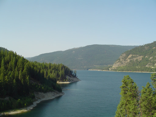

WOW!
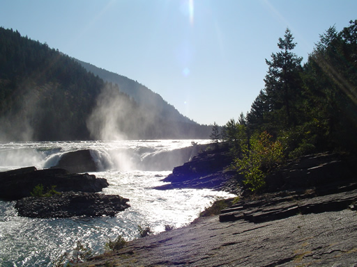
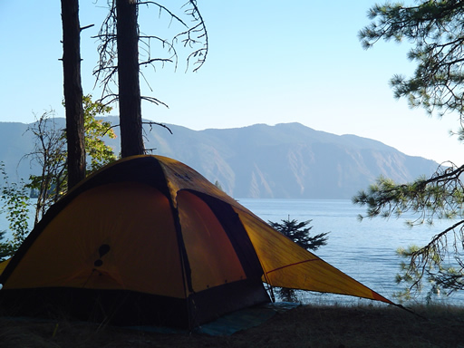
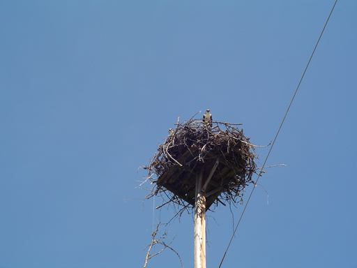
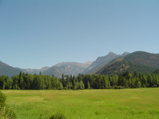
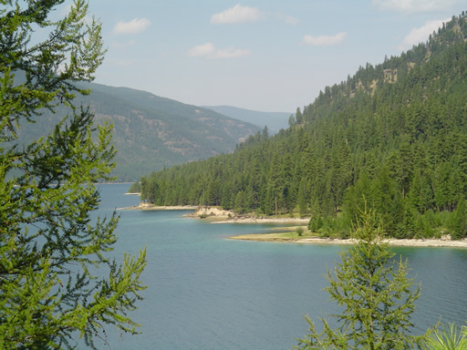
We think we found Cycling Heaven on Route 37 from Eureka to Libby. Cycling heaven is 65 miles of ospreys, bald eagles, mountains, Lake Koocanusa, Kootenai River, and a quiet road. Our eyes and brains hurt from trying to enjoy all that was around us. We found ourselves not saying anything for long stretches, just lost in our own thoughts. These two photos are all we need to explain.
We met a fellow teacher, cycling across on the northern tier. Fred Brown is biking, with his wife Gania following in a motor home, across America from west to east. You can read more about his adventures at: http://web.mac.com/fbrown5/iWeb/Bike%20Trip/Welcome.html
We took a rest break at the Libby Dam. Libby Dam is the culmination of years of effort on the part of both the United States and Canada to develop a flood control plan for the Columbia River basin. Lake Koocanusa was named by using the KOO in Kootenai River, the CAN in Canada and USA. The Kootenai River is the third largest tributary of the Columbia River, contributing almost 20 percent of the total water in the lower Columbia. The dam stands 422 feet tall and about one-half mile long and creates a reservoir (Lake Koocanusa) which provided the backdrop of our canvas today.

Posted in Across the USA |
08/05/2006 04:18:40 by Administrator
Posted in Across the USA |
08/06/2006 04:20:12 by Administrator
Posted in Across the USA |
08/07/2006 04:21:41 by Administrator
From: New Port, Washington
To: Ione, Washington
Mileage: 53

Our ride today paralleled route 20 on the other side of the Pend Oreille River on North LeClerc Road. Yet another stellar ride, we know we keep writing that sentence, but it is just . . . true. Quiet road, ospreys, turkeys, golden AND bald eagles, Selkirk Mountains, Pend Oreille River and for added enjoyment, a herd of bison!
We met a fellow northern tier cyclist, Fred, a couple of days back on Route 37, and he had warned us about road construction around Newport. Keeping this in mind, we had breakfast downtown then proceeded to the information center in Newport. The gentleman at the center was very nice, and told us of road construction on Route 20 from Usk to Cusick. After showing him the Adventure Cycling map, which showed our route on LeClerc road. He assured us that there was NO construction that way.
You are guessing correctly, 5 miles into our ride on LeClerc road we encountered road construction. While waiting for the "follow truck", we had a great conversation with the two flag women. They had seen a number of cyclist going both east to west and west to east and actually told us the major stops that we will be making and have taken on this section of the Adventure Cycling map. After about 15 minutes, the follow truck showed up, and SeeMore bravely followed behind through 1.5 miles of road construction. One section had pretty soft sand (this is SeeMore's number one fear!), but we made it through and really enjoyed the rest of today's journey.
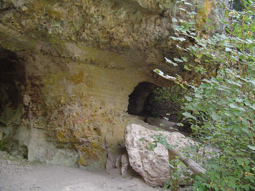
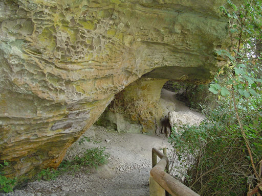
We stopped at Manresa Grotto for a rest break (the two photo today are of Manresa Grotto), it is a couple of caves carved out of the rock when the river was at this level. We then had a picnic lunch at the Panhandle Campground (USFS), yet another campground with water front sites.
Today was not all wine and roses. Noel had his first sick day of the trip. He had a pretty bad headache, and not sure if it was caused by allergies, smoke (there are multiple forest fires burning in Washington state), or some bad food. His headache finally cleared about 10 miles from Ione, and thankfully so because it reached 94 degrees at 3:00.
We spent the afternoon out of the sun, and will investigate Ione once the sun gives us a break.

Posted in Across the USA |
08/08/2006 04:22:59 by Administrator
From: Ione, Washington
To: Kettle Falls, Washington
Mileage: 55
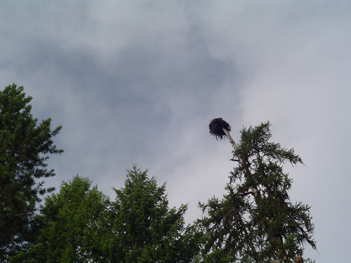

Today was a tune up for tomorrow's Sherman's Pass. We had to get over the Selkirk Mountains on our way to the Cascade Mountains. It was another beautiful ride and the riding conditions were near perfect. So far Rte 20 is very light traffic. We had an overcast sky with temperatures rising to 91 degrees, but by the time that happened, we were pretty much done for the day except for riding around Kettle Falls to see what we could see.
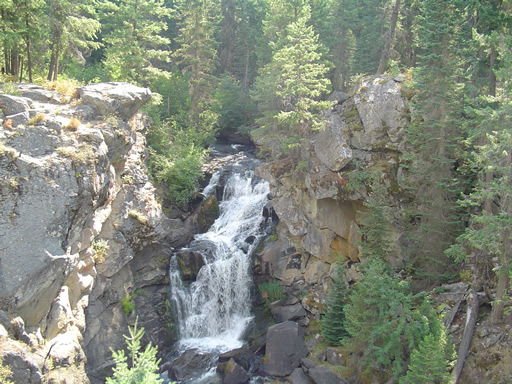
After turning on to Rte 20 (about 4 miles into the ride) we were greeted with a five-mile ascent with a number of switchbacks. One pedal at a time brought us up and over onto a 10 mile plateau through the Selkirk Mountains and Colville National Forest. The only thing missing in the tall pines, dark mountains, and marsh grassland was a moose or two! It was just like being at an Imax theater (only better!), except SeeMore was our seats and yes we had to pedal a couple of times.
After our decent out of the Colville National Forest, the Adventure Cycling map takes you on side roads into Colville (population 5000). We had little trouble with these side roads, but for the west to east riders . . . we would suggest staying on Rte 20. It has the same scenery, and the climb out of Colville is very steep.
Lunch in Colville was proceeded by a ride around town. Afterwards, it was a short ten-mile ride to the small town of Kettle Falls (population 1500). Tomorrow the climbing begins in earnest.

Posted in Across the USA |
08/09/2006 04:24:22 by Administrator
From: Kettle Falls, Washington
To: Republic, Washington
Mileage: 44
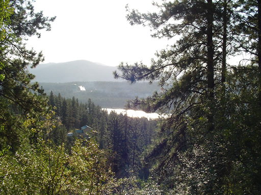

We had a great dinner last night at the Apple Warehouse Deli in Kettle Falls. We split a sandwich and shared a Greek salad that was just perfect. They also had home baked cookies and goodies, which we also easily consumed!
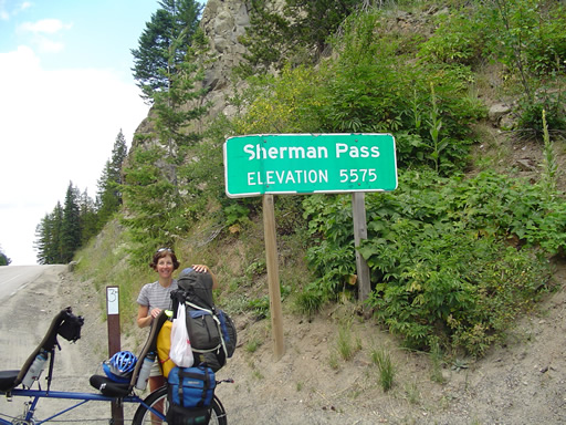
The morning ride began with a 3 mile decent to cross over the Columbia River. It was quickly followed by a 25-mile ascent of Sherman's Pass. This was not easy, we are guessing that we averaged between 4-5 mph for most of the 25 miles, especially the last 7.
On the way up, the Rear Admiral spotted a rest area with rest rooms. She said, "I'm going to signal left". What I saw was a single touring cyclist coming down from the pass, so naturally I pulled up next to him. He was from Germany, and spoke very little English. We are from America, and speak very little German. We think he is making a loop from Seattle to Colville Washington, then up to Canada and over to Vancouver before finally returning to Seattle. He was a very nice gentleman; we just wish we could have communicated with him better. So after he continued down hill, I start to pedal SeeMore back onto Rte 20 and continue up the mountain. However, the Rear Admiral wanted to continue to go left and towards the rest area. SeeMore doesn't go very well in two directions at one time, so naturally he didn't. This was a rare time on this trip that our minds were not in tandem.
The pedaling might have been a challenge, but the scenery was grand and it made the efforts easier to handle. At one time we believed we startled a moose in the marsh next to the road. All we heard was the sound of something very large, sloshing to get out of the water. Could have been Bigfoot, now that we think about it!
We are here in beautiful Republic Washington (population 956, maybe). It is a pretty nice small town nestled in between two passes; Sherman and tomorrow's challenge Wauconda (elevation 4310). As I type this, the Rear Admiral is sleeping (3:00 pm). She worked very hard today, and I am truly blessed that she was able to pedal me up the hill!

Posted in Across the USA |
08/10/2006 04:27:46 by Administrator
From: Republic, Washington
To: Okanogan, Washington
Mileage: 72
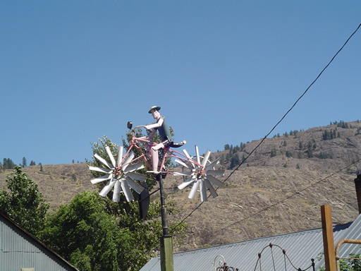

Another day, another stellar bicycling ride with some surprises along the way. We had a short climb (about 14 miles) to go up and over Wauconda pass. Not a lot of challenge, taking it one pedal at a time we were surprised that we had reached the pass so easily. Next we had a 25-mile down hill into Tonasket and into the Okanogan valley. The valley is very arid, except for the Okanogan River and the thousands of fruit trees (apple, nectarines, peaches, pears) that are irrigated from the river. We were very surprised how much this section of Washington looked like Montana with rocks, cacti, dried grasses, sage, and cliffs. . . except, of coarse, the fruit trees!
We had lunch in Tonasket, and this is where route 97 joins route 20, which makes for a rather busy stretch of road. Adventure Cycling has a few side roads that keep you away from a lot of the 97/20 traffic. So far when Route 20 is by itself, and not joined by another route, it is very quiet.
We also had our first dog chase of the trip. A very fast Jack Russell Terrier (picture Eddie on the TV show Fraser) came at us as we tried to reach maximum warp speed. SeeMore was riding into a headwind, and 17 mph was all he was willing to give. The Jack Russell was willing to give 21 mph. The Rear Admiral, with the speed and accuracy of a modern day Annie Oakley, shot the Jack Russell right between the eyes with a blast of ice-cold water from my water bottle. The dog was defeated, and I lost some valuable ice-cold water. . . but ankles were saved in the process! (did I mention I lost some valuable ICE-COLD water?)
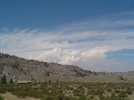
There are a number of extremely large forest fires burning north of Okanogan and northeast of Winthrop. The Tripod and Spur Peak fires have burned more than 74,800 acres, or nearly 117 square miles, of national-forest land. They were both started by lighting, and have been burning since July 24th and are only 20 percent contained as of this writing. We could see the huge amount of smoke coming over the tops of the mountains as we rode in the Okanogan valley today (see photo below).
Tomorrow is the Loup Loup pass (elevation 4020) and we are hoping for two non-smoking seats on SeeMore as we travel just south of the fires.

Posted in Across the USA |

![]()

![]()

